Surveying Their Way to Land Rights: Belize’s Maya Women’s GPS Mapping Team
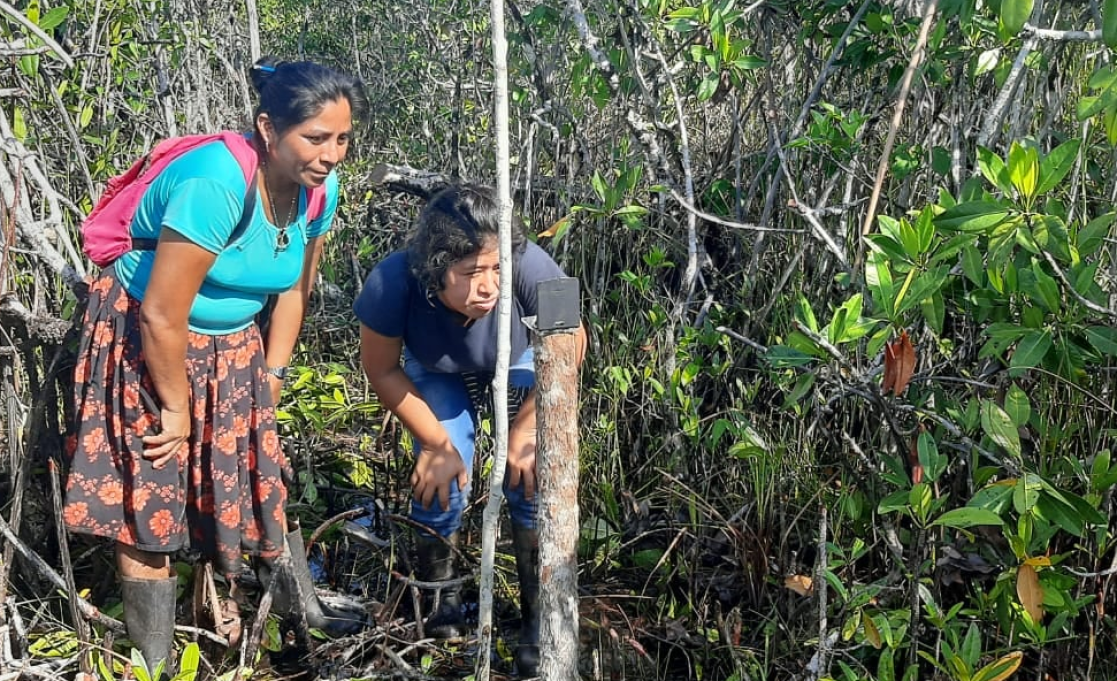
For Belize’s Maya Women GPS Mapping Team, the struggle to preserve indigenous land is intimately linked to the work the group has done over the past three years. With funding from the European Union, and technical support from the Non-Governmental Organization (NGO) Sarstoon Temash Institute for Indigenous Management (SATIIM), the women of the Maya villages of San Antonio, Conejo Creek, Sunday Wood, and Midway in the district of Toledo in southern Belize have been pinpointing the boundary lines between their villages. It’s not easy work, considering that those boundaries lie in some of Belize's most remote places. It involves long days and even longer treks through dense mangroves and swampy jungles. But for women like Rosa Teul of Conejo Creek, every difficult journey has been worth it.
Rosa is one of the women who make up the first-ever all-Maya women GPS mapping group. And for her, the technical training that she and her fellow community members have received is invaluable.
“At first, we only ever heard the word GPS but we didn’t know what it is, what it does, how it looks.
But now we’ve been given this opportunity to learn how to use it,” she said.
Now, it is a tool that the women can use to have a direct role in preserving their land for future generations to come.
The Importance of Mapping Indigenous Land
Belize Technical Office
Belize Technical Office
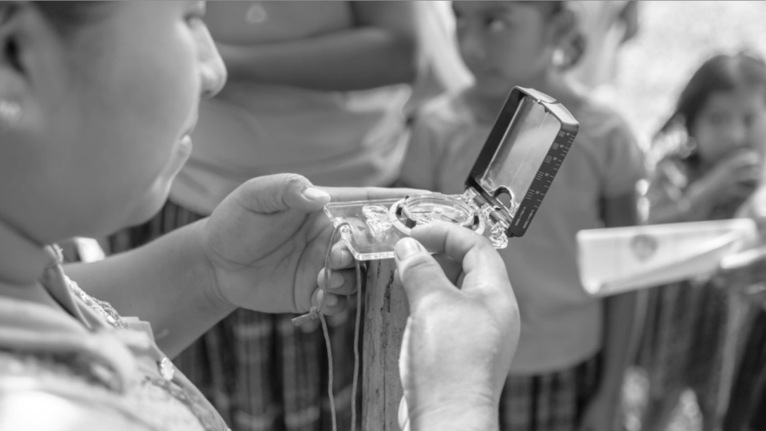
Training for the Maya Women GPS Mapping Team involved both learning theory and doing field work
The demarcation of land borders between villages is an important step in the eight-part process of defining and delimiting the territories of the Maya people.
In April 2015, the Caribbean Court of Justice (CCJ) passed down a landmark decision reaffirming that the Maya people of Belize hold customary land rights over the territory that they occupy. The delimitation process aims to pave the way for the indigenous communities to eventually receive proper land titles.
The struggle to secure land rights for indigenous peoples is not isolated to Belize, nor is it a newly emerged issue. Similar to Belize, indigenous groups in countries like Brazil and many other countries in Central and South America and other regions of the world, have also joined in the indigenous land rights movement.
Empowering Maya Women: Promoting and Protecting the Economic, Social, and Cultural Rights of Maya Women in Belize
The European Union in Belize partnered with SATIIM, an indigenous-created and run organization led by a Maya woman with a majority Maya women staff, in launching the Empowering Maya Women Project in December 2019. The project, which ended in February this year, goes hand in hand with the European Union’s stance on promoting and protecting the economic, social, and cultural rights of Maya women in Belize. And through it, Belize’s Maya women, for the first time ever, were able to learn and work as trained technicians and data collectors.

Belize Technical Office
A day in the field: collecting data about the surrounding environment
Rosa and the women of her community, took part in a three day training on GPS mapping techniques. Day one involved learning the theory behind GPS mapping. Then, on the following days, the team went out into the field. In total, 45 Maya women were trained.
They began with mapping farms of nearby homes right inside their communities. They calculated the total area of farms, collected data about crops and other flora in the area, and, for the first time ever, included in the data farms headed by Maya women. After that, they went out into the swamps to map their community boundaries.
Even for Rosa, the fact that indigenous women are now occupying a field once fully dominated by the men in her community is inspiring. Thanks to the initiative, the women now have a pivotal role to play in securing and preserving indigenous land rights.
“Without it, I don’t know if we would have been here where we are today,” she said.
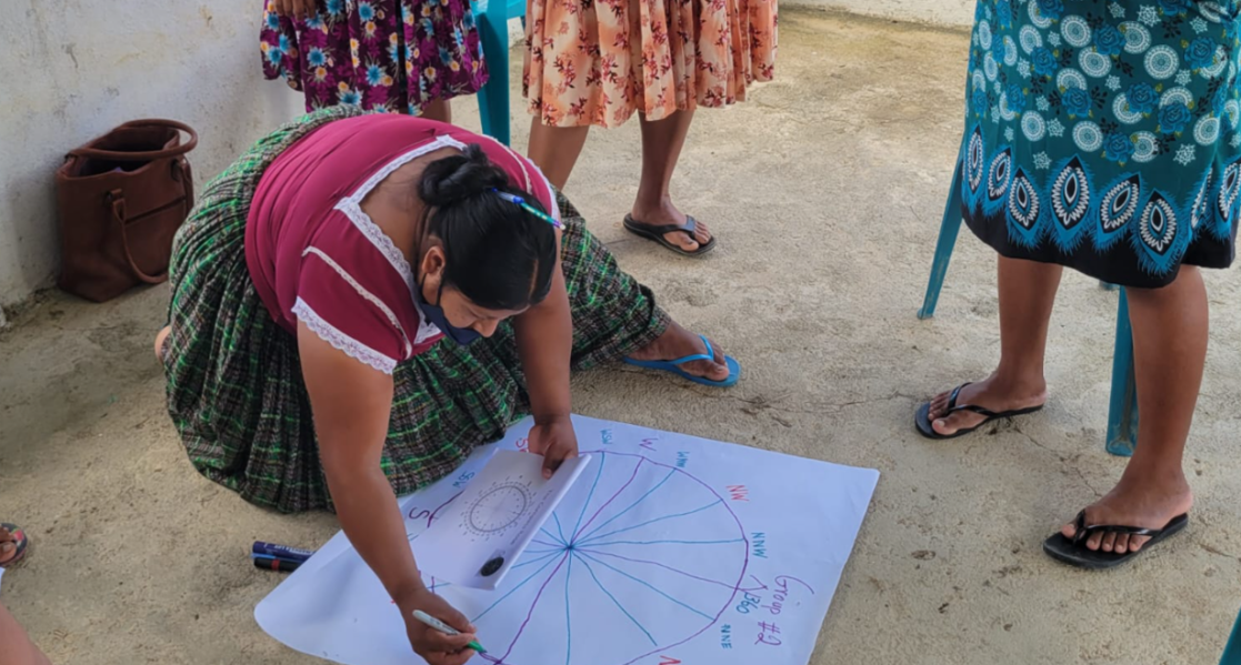
Eleven women from the team were also trained in public speaking. These women went on to train others in GPS mapping and the Free Prior and Informed Consent (FPIC), a specific right that pertains to indigenous peoples and is recognised in the United Nations Declaration on the Rights of Indigenous Peoples (UNDRIP). They have also been attending and standing up to speak in community meetings - something that was once unheard of.
In early 2022, Rosa Teul would be one of the women who guided her village Alcalde[2] and chairman through swampy jungle to identify the boundary line between Conejo Creek and Sunday Wood. Later, in March 2023, she and the rest of the Maya Women GPS Mapping team would celebrate the completion of the three-year empowerment program with a beautiful closing ceremony attended by Belize’s Governor General, Dame Froyla Tzalam, a former director of SATIIM, together with representatives of the Government of Belize, EU and civil society.
The European Union supports indigenous people’s rights and full participation and consultation of indigenous people’s communities in decision-making processes through the Free Prior and Informed Consent (FPIC). At global level the EU has committed to make all possible efforts to respect, include and promote indigenous issues in its programmes.
(END)